Satellite image of Hurricane Laura from just after dawn today.
Hurricane Laura is rapidly strengthening as it heads towards Louisiana and Texas. It’s expected to make landfall as a category four storm. It was a category one as late as yesterday. Maximum sustained winds increased by 65 mph in the 24 hours ending 1 p.m. CDT on Wednesday.
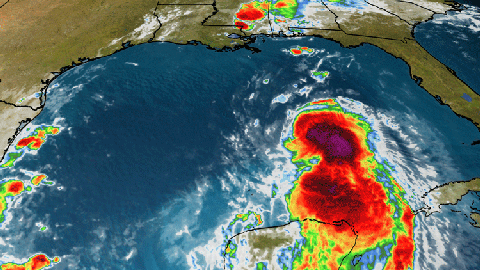
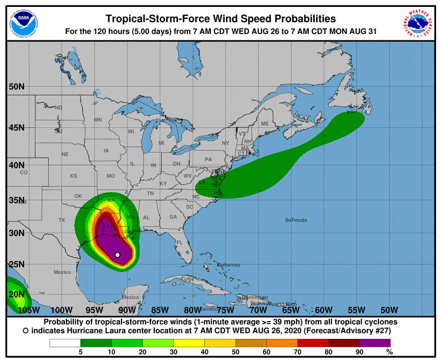
This is a dangerous storm, with Tropical storm force winds extending at least 175 miles from the eye.

See also: National Dog Day
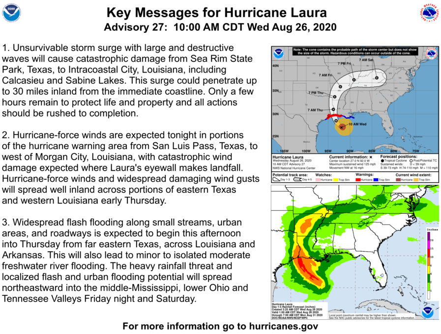
From the National Hurricane Center:
SUMMARY OF WATCHES AND WARNINGS IN EFFECT:

A Storm Surge Warning is in effect for...
* Freeport Texas to the Mouth of the Mississippi River

A Hurricane Warning is in effect for...
* San Luis Pass Texas to Intracoastal City Louisiana

A Tropical Storm Warning is in effect for...
* Sargent Texas to San Luis Pass
* East of Intracoastal City Louisiana to the Mouth of the
Mississippi River

A Storm Surge Watch is in effect for...
* Mouth of the Mississippi River to Ocean Springs Mississippi
* Lake Pontchartrain, Lake Maurepas, and Lake Borgne

A Hurricane Watch is in effect for...
* East of Intracoastal City to west of Morgan City Louisiana
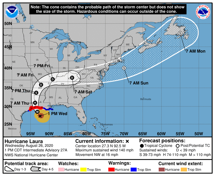
DISCUSSION AND OUTLOOK
----------------------
At 100 PM CDT (1800 UTC), the eye of Hurricane Laura was located
near latitude 27.3 North, longitude 92.5 West. Laura is moving
toward the northwest near 16 mph (26 km/h). A gradual turn toward
the north-northwest and north is expected later today and tonight.
On the forecast track, Laura will approach the Upper Texas and
southwest Louisiana coasts this evening and move inland within
that area tonight. The center of Laura is forecast to move over
northwestern Louisiana tomorrow, across Arkansas Thursday night, and
over the mid-Mississippi Valley on Friday.

Reports from an Air Force Reserve Hurricane Hunter aircraft indicate
that maximum sustained winds have increased to near 140 mph (220
km/h) with higher gusts.  Laura is an extremely dangerous category 4
hurricane on the Saffir-Simpson Hurricane Wind Scale.  Some
additional strengthening is possible this afternoon, and Laura is
forecast to remain a category 4 hurricane through landfall tonight.
Rapid weakening is expected after Laura makes over land.

Hurricane-force winds extend outward up to 70 miles (110 km) from
the center and tropical-storm-force winds extend outward up to 175
miles (280 km). Tropical-storm-force winds have reached the coast
of Louisiana and an observing site at Eugene Island recently
measured sustained winds of 39 mph (63 km/h) and a gust to 64 mph
(104 km/h).

The latest minimum central pressure estimated from reconnaissance
aircraft data is 952 mb (28.11 inches).