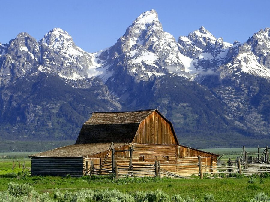
Icons of the American West – Part 3
Jack Rabbit
There are predominately two species of Jack Rabbits in the western US, the black tailed (Lepus californicus) and the white tailed (Lepus texianus). Contrary to common belief, jack rabbits are not a true rabbit at all; they are truly a member of the hare family of mammals.
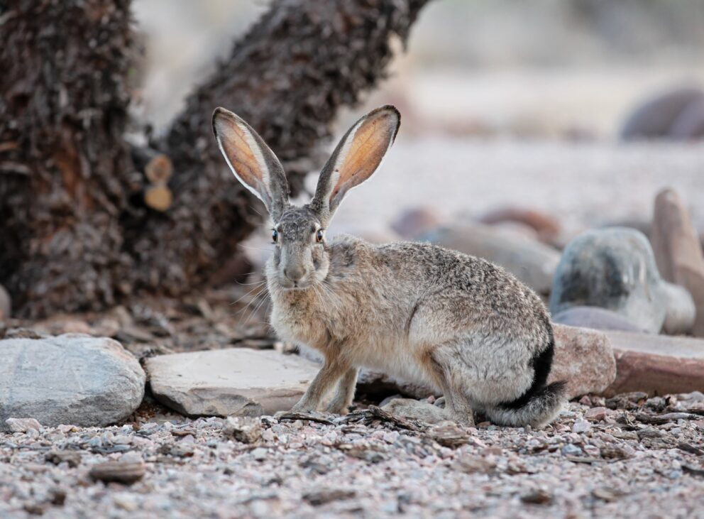
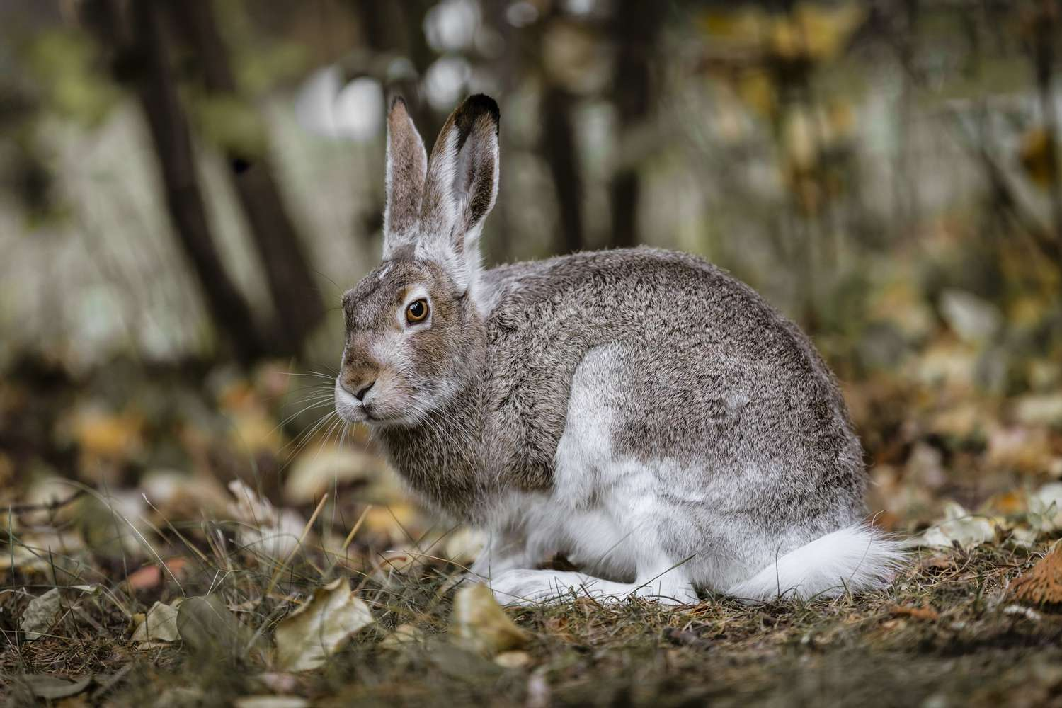
There are a total of 6 subspecies but the most prevalent varieties are the black tailed and white tailed with the white tailed being the dominant species on the plains while the black tailed dominates west of the Rocky Mountains. Both species cover a large area ranging from western Missouri to the west coast with populations occurring from sea level to about 10,000 feet. The diets of both species are predominately grasses and shrubs but may contain alfalfa and young wheat and other grains when available.
Females are larger than the males but there are no other significant differences. The black tailed is the more widely distributed of the two. The white tails’ lesser and declining population may be due to more land being used for agriculture on the plains than the more mountainous terrain west of the Rocky Mountains.
The two species do cross breed but not to any great degree. This may change as the black tailed species is increasing its range into the Great Plains to the detriment of the white tailed variety.
Long ears and powerful rear legs give the jack rabbit its common appearance. Known for its ability to run at speeds of 40 mph for short distances with leaps that may reach 10 feet gives it the ability to evade and/or out run many of its predators.
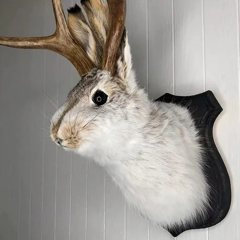
Author’s note: Phantom Byte reminds me that I would be remiss if I did not mention the very elusive Jackalope. We know such a creature must exist due to its large numbers by collectors of oddities and its prevalence in taxidermy and curio shops. Its range is not confined to any one area, but it is highly prevalent on the Llano, a land of fables and tall tales, prickly pear, rattlesnakes and cow pies, both the desiccated and fresh varieties in addition to being the haunt of the ghosts of Charles Goodnight, John Chisum, Pat Garret and William Bonney.
The Blue Spruce
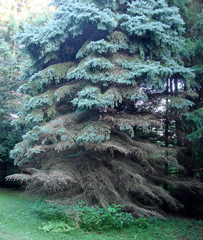
This species of spruce (Picea pungens) is a naturally occurring conifer in the mountains of Arizona, Colorado, Idaho, New Mexico, Utah and Wyoming. It grows at elevations from 5,000 feet in its northern range to 12,000 feet in its southern range. It can attain a mature height of 75 feet with its lower branches spreading out to about 16 feet.
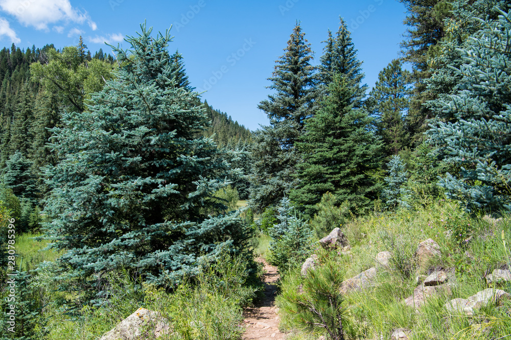
It is a naturally occurring columnar conifer that is also highly regarded as an ornamental for urban gardens and parks far beyond its native range. Its sharply pointed leaves, more commonly called needles curve upwards and are arranged radially on its dense horizontal branches.
Mites, spruce beetle and spruce budworm larvae are among its enemies that can and do cause die offs across its natural range. Despite its shallow roots, this variety of spruce is seldom a victim of winter blow down and is resistant to mild drought and sub-zero temperatures.
The Navajo tribe considers the tree a medicinal plant, a ceremonial item and a good fortune item when given as a gift. An infusion of the needles is used internally for the treatment of colds and as a sedative for stomach ills and externally for rheumatism by the older population.
The blue spruce is common in riparian areas with well-watered soils and lower northern slopes. It grows well in cool, humid soils among other riparian trees and shrubs.
The Blue Spruce is the state tree of Colorado.
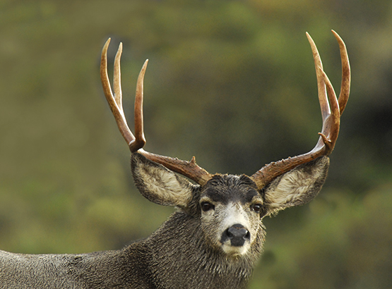
Mule Deer
Mule deer (Odocoileus hemionus) is found across a large part of the American west: from the western Great Plains, the Rocky Mountains, the greater southwest and the west coast of North America. It is the species’ large ears that give the mule deer, muleys as they are commonly called, its name.
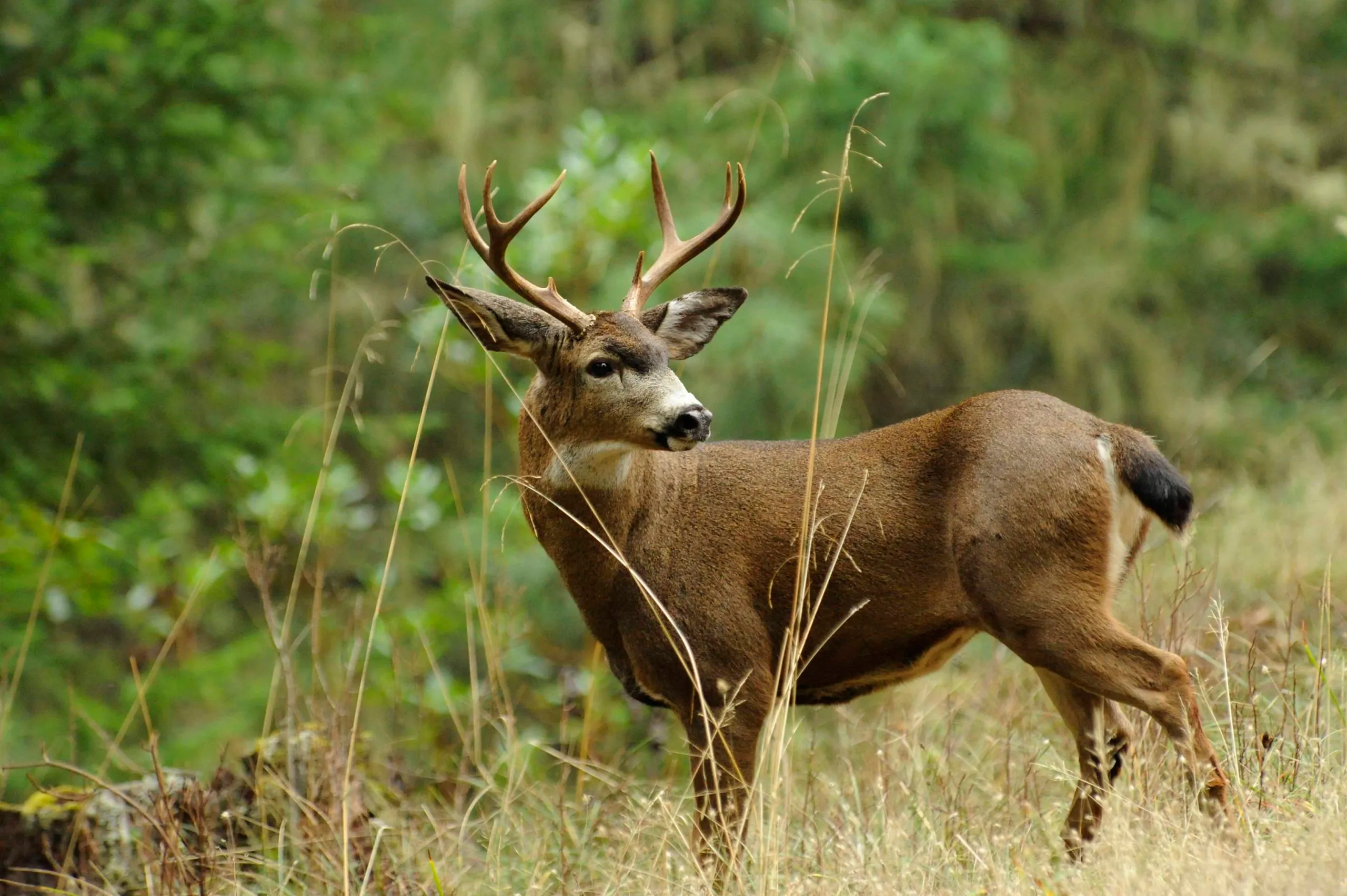
Mule deer are divided into two main groups, the mule deer (sensu stricto) and black tailed deer. The coastal mule deer do not achieve the large size that is common among the rest of the mule deer species. Their range is extensive as they are found from coastal Alaska, the northern Yukon south into northern and central Mexico.
White tail deer are also spread across much of the west but muleys can be identified by ear size, its black tail color and antler configuration. Muley antlers are bifurcated rather than branching from a main beam as is the case with White Tails. Muley bucks shed their antlers during the winter months and regrow them in the spring. Changes in the length of the seasons, notably the lengthening days trigger the regrowth of the antlers.
The diet of Muleys are intermediate feeders rather than grazers or browsers, as they may eat tree and shrub fruits plus sagebrush where available. Being ruminates, they are opportunistic, and they will consume alfalfa and young grain if available and a wide variety of fall mushrooms that provide them with necessary vitamins and minerals.
Mule deer are migratory, especially in areas that have harsh winter conditions as they migrate to lower elevations as food sources are often covered with snow. They may migrate as far as 150 miles from summer ranges to lower elevations. Studies suggest that mule deer migrations are a result of cognitive memory and may use the same routes year after year. Urban development, fences and highways may act as barriers to migration resulting in a declining mule deer population overall.
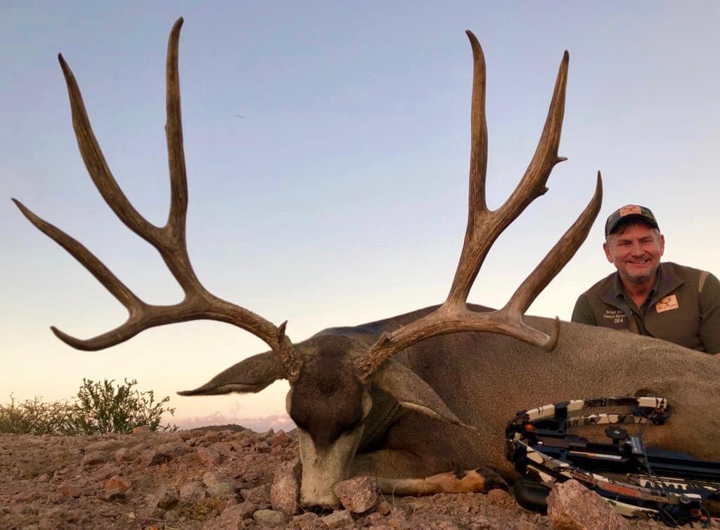

Mule deer are smart and may elude hunters by laying down in brushy areas waiting for the hunter to pass, often within 15 yards then scampering to their feet, often to disappear over a ridge or into an arroyo to avoid the hunter; as this old mule deer hunter has learned the hard way.
Volcanoes of the Cascade Range
Volcanoes dominate the Cascade Range from southwestern British Columbia to Northern California in a 700+ mile arc known as the Cascade Volcanic Arc. Plate tectonics create what is known as the Cascadia subduction zone, a 600 mile long zone where the Explorer, Juan de Fuca and Gorda plates slide beneath the much larger North American Plate. This zone is capable of producing 9.0+ magnitude earthquakes and tsunamis that may reach a height of 100 feet. The Cascade volcanoes are the result of this subduction zone.
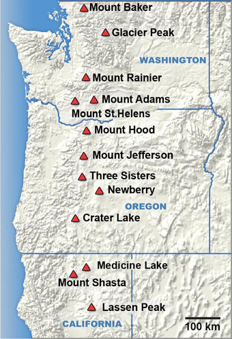
Excluding the volcanoes of British Columbia the US west coast is dominated by these peaks that on average are over 10,000 feet in elevation. Beginning in northern Washington State with an active 10,781 foot Mount Baker; the second most thermally active volcano in the Cascade Range and ranks second in glaciers and snowfield cover exceeded only by Mount Rainier. Mount Baker’s glaciers and snowfields are greater than all the other Cascades volcanoes (with the exception of Mount Rainier) combined. It also holds the world record for snowfall in one winter season with a total of 1,140 inches of snow, or 95 feet.
Next is 10,525+ Glacier Peak which lies but 70 miles northeast of downtown Seattle. Glacier Peak is one of the most active of the Cascade volcanoes and in its history has produced some of the largest and most explosive eruptions in the state. As the last of the continental ice sheets retreated Glacier Peak began erupting regularly, erupting explosively 5 times in the past 3,000 years.
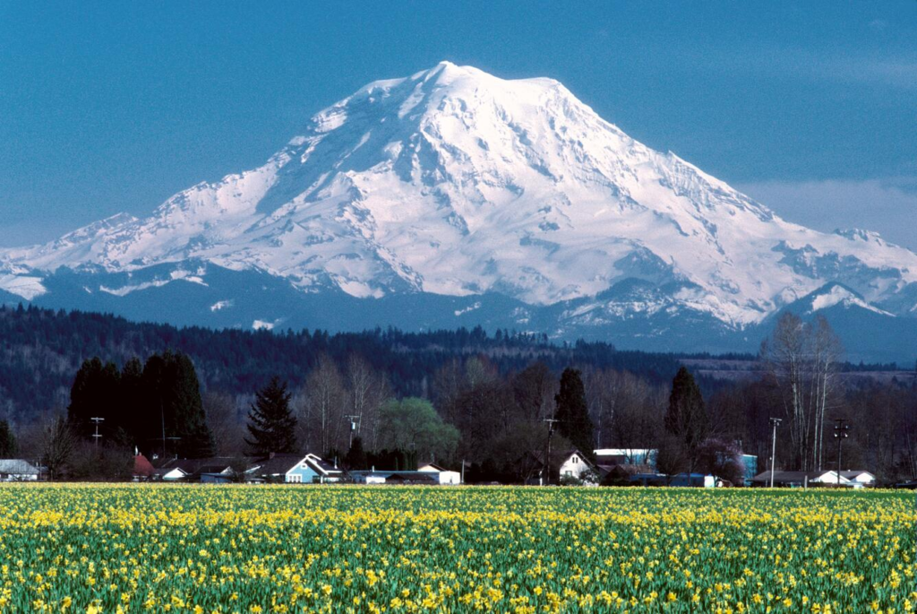
Next is 14,411 foot Mount Rainier, tallest of the Cascade volcanoes lying less than 60 miles from Seattle. It is considered one of the most dangerous volcanoes in the world plus its large glaciers and snowfields are capable of producing lahars that could engulf most of the heavily populated Puyallup River Valley.
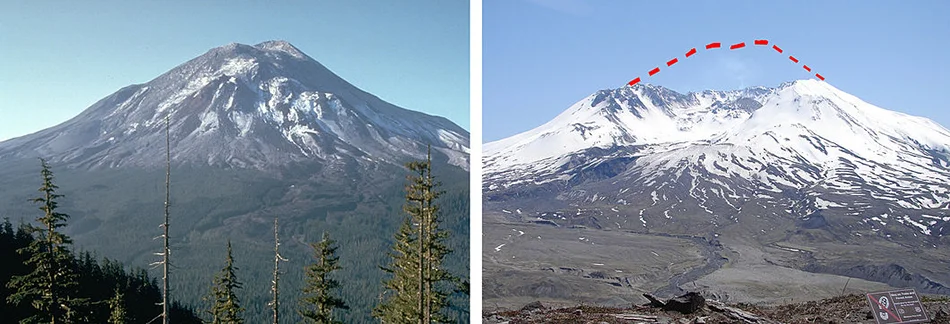
Continuing south next is very active 8,363 foot Mount St. Helens, a volcano that lies 52 miles northeast of Portland, Oregon and 98 miles south of Seattle. The 1980 eruption of St. Helens reduced the mountain’s elevation from 9,677 feet to its current height, leaving a mile wide crater. 57 people lost their lives on May 18 1980; over 200 homes, 47 bridges, 15 miles of railway and 185 miles of highway were destroyed. The resulting ash plume closed highways as far east as Montana and turned day into night across Eastern Washington, Northern Idaho and Northeastern Montana. When considered on a global scale, most volcanologists consider the Mount St. Helens eruption to be a minor eruption, but not by the people directly affected by the eruption.
Next is 12,281 foot high Mount Adams, a large mountain some 34 miles east of Mount. St. Helens. Although it has not erupted in the last 1,000 years, it is not considered to be extinct as it has numerous steam vents near its glaciated summit.
This concludes the list of volcanoes located within the confines of the state of Washington.
Crossing the Columbia River we encounter the first of Oregon’s volcanoes beginning with 11,249 foot Mount Hood located approximately 50 miles east-southeast of Portland, Oregon. As a skiing resort, it offers the only year-round lift accessible ski area in the lower 48 contiguous states.
Home to 112 named glaciers and snowfields and the highest mountain in the state, Mount Hood is considered the most likely to erupt of Oregon’s volcanoes; but based on its geologic history an explosive eruption is considered unlikely.
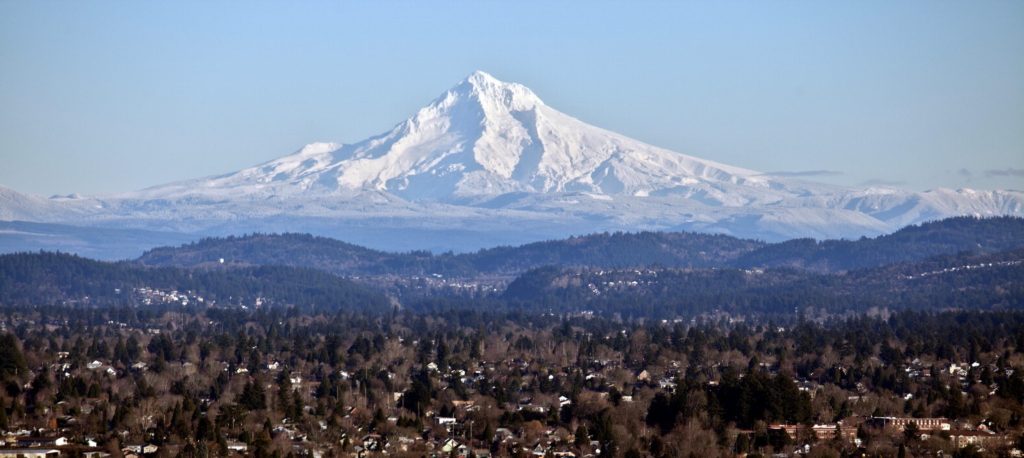
The Corps of Discovery first spotted Mount Hood October 18, 1805 from atop a tall promontory near the confluence of the Snake, Walla Walla and Columbia Rivers in current day Washington State.
Next is 10,502 foot high Mount Jefferson located in a wilderness area of the same name. It is in a remote area with no roads and rough terrain making journeys to the remote mountain both long and difficult. Surrounded by numerous volcanic features, it is not considered a major threat of eruption but it is considered a major threat due to mudflows around the area.
Continuing south along the crest of the Cascades we encounter “The Three Sisters”, a series of volcanic peaks that due to their close proximity to one another are listed as one mountain. Although they are close, they are three different mountains with each having different geologic and eruptive histories.
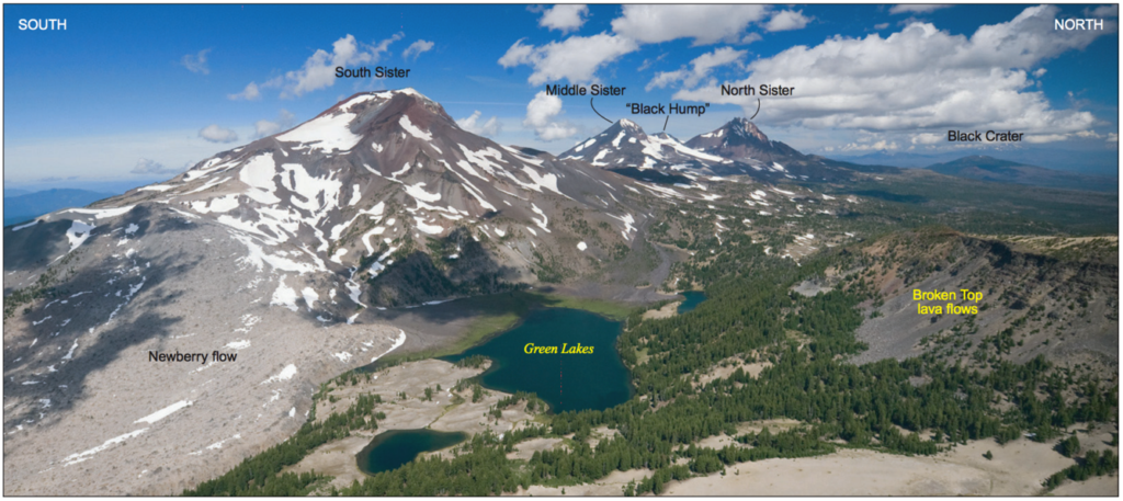
They are all over 10,000 feet with the North Sister’s elevation listed at 10,090 feet; the Middle Sister at 10,052 and the South Sister with an elevation of 10,363 feet. The North and Middle Sisters are no longer considered likely to erupt again; but the South Sister could erupt in the future after Satellite imagery detected some up lift in 2000 causing the US Geologic Survey to improve monitoring around its perimeter.
7,989 foot Newberry Volcano is a large active shield volcano approximately 20 miles south of Bend, Oregon. Its caldera measures 4 x 5 miles, making it the second largest volume caldera of the Cascade volcanoes. Its location makes it among the most accessible volcanoes in the Cascadia Volcanic Arc. Measuring in at 620 square miles it is the largest of all the Cascade active volcanoes; when its lava flows are part of this measurement, from north to south it runs for 75 miles and east to west of 27 miles covering an area of 1,200 square miles. As it is considered an active volcano, it has the potential of erupting producing lava flows, pyroclastic flows, lahars, ashfall, earthquakes, avalanches and floods. The US Geological Survey monitors this volcano closely due to its active status.
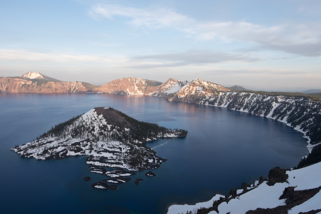
Crater Lake is the caldera of what was once 12,000 foot Mount Mazama that erupted some 7,700 years ago. As the magma chamber emptied the top of Mount Mazama collapsed into itself and Crater Lake formed as a result. Mount Mazama is considered dormant, but the geologic features that surround the lake could result in small eruptions that would affect areas in close proximity to the existing crater.
9,493 foot Mount McLoughlin is a volcano in southern Oregon that is considered to be dormant as its last eruptive stage was between 20,000 and 30,000 years ago. As a result, it is no longer monitored for deformation or other geologic actions. The northeastern flank of the volcano has eroded, consequently transforming the flank into a hollow amphitheater; while the rest of the peak retains its symmetrical appearance.
This concludes the list of volcanoes within the confines of the state of Oregon.
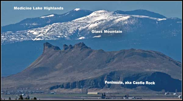
7,921 foot Medicine Lake volcano is California’s most northerly volcano; a large shield volcano that is surrounded by numerous lava flows with a large (4.3 by 7.5 mile) caldera as its main feature making it the largest volcano by volume in the Cascade Range. This volcano has been active for 500,000 years with gentle eruptions from numerous small magma chambers in contrast to violent eruptions from one crater of Washington State’s Mount St. Helens. Glass Mountain is part of the Medicine Lake volcano and erupted about 1,000 years ago. Its main feature is the large area of obsidian flows that ran down the steep eastern flanks of the main volcano.
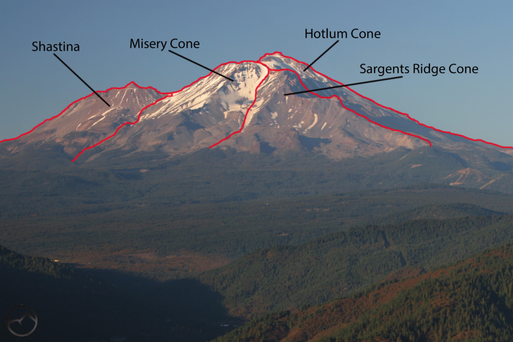
14,179 foot Mount Shasta is considered to be an active volcano with 4 volcanic cones that dominate the surrounding area and can be seen from a distance of 140 miles on a clear day. Mount Shasta has 4 glaciers radiating down to about the 10,000 foot elevation mark on the north and east slopes of the main mountain. Shasta’s last proven eruption occurred around 1250 AD; a disputed eruption was reported in 1786. John Muir and John Wesley Powell, while doing scientific study of the mountain, may have reached Shasta’s summit in 1877 but some historians say the party was not successful in attaining the summit. Muir reportedly survived a blizzard on the mountain by laying in a hot sulfur spring during one his many trips to Mount Shasta. In February 1959 a ski resort on the mountain set a record for the most snowfall in one storm in the US with a total of 15.75 feet.
10,457 foot Lassen Peak is the southernmost of the Cascade volcanoes. An active volcano, although considered dormant, not extinct, was active with eruptions from 1914 to 1921 generated an explosive eruption May 22, 1915 that devastated nearby areas, spreading ash for 280 miles to the east of the peak. Lassen has an active magma chamber that is still capable of producing eruptions that pose a threat with lava flows, pyroclastic flows, lahars, landslides and debris flows and is continually monitored.
This chain of 15 volcanoes, many of which are still considered to be active make up some of the most beautiful and photographic areas in the western United States.
You can find parts one and two of this series here and here.